
Page 30 - AA 2025 Year Book Summary
P. 30
Libya
Launch of a Geospatial Platform for supporting
sustainable cropland and water
The Italian Agency for Develop-
ment Cooperation (AICS) and the
Food and Agriculture Organiza-
tion of the United Nations (FAO),
in cooperation with the Ministry of
Water Resources, the Ministry of
Agriculture and Livestock, and the
Libyan Centre for Remote Sensing
and Space Science are launching
the “MerWat-Libya” Geospatial Plat-
form. This platform will provide geo-
spatial information to support water
resource management in Libya and
will enable national partners to ac-
cess a vast amount of spatial infor-
mation to support sustainable water land and water management, ag- cant stride towards shared goals of
and crop production while consider- riculture and environment sectors. sustainability and resilience in agri-
ing available natural resources. The presentation provided a clear cultural practices. A demonstration
The Geospatial platform is one of overview of the structure, compo- of Italy’s leadership and commit-
the main results of the project “Mon- nents and usage guidelines of the ment to leveraging knowledge and
itoring, Evaluation and Rationaliza- platform, and was attended by rep- technology for impactful decisions
tion of Water Use for the Agricultural resentatives from institutions, aca- in the agriculture and environment
Sector in Libya”, funded by the Ital- demia, science and civil society. sectors, in close collaboration with
ian Ministry of Foreign Affairs and the UN and for the direct benefit of
International Cooperation (MAECI), Deputy Ambassador Riccardo
through a 830,000 euros-grant. This Villa, underscores the critical role of partner countries.”
innovative tool serves as a hub for the MerWat-Libya Geospatial Plat- M. A. Maki Abdourahman, rep-
digital data exchange and dialogue, form in strengthening the partner- resenting FAO-Libya, underlined
underscoring the growing impor- ship between Italy and Libya. “This the importance of the achievement
tance of geospatial technology in technological leap marks a signifi- of this project. He highlighted the
modern agriculture. It offers com-
prehensive capabilities for access-
ing, storing, processing, and ana-
lyzing spatial data and it is essential
for making informed decisions in
agricultural development using ad-
vanced geospatial information and
data. It also incorporates datasets on
crop types, cultivated field bound-
aries, hydrological basins, and soil
classification, empowering stake-
holders with precise information for
informed decision-making.
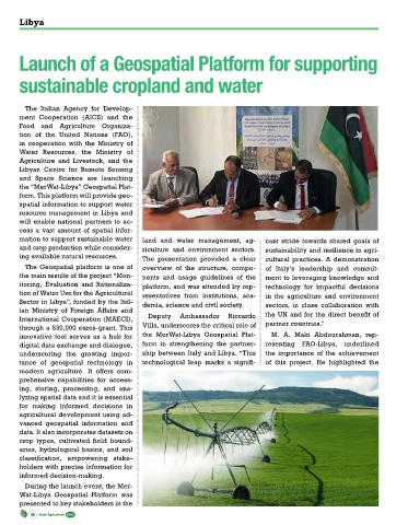
During the launch event, the Mer-
Wat-Libya Geospatial Platform was
presented to key stakeholders in the
28 Arab Agriculture 2025